Environmental Impact Assessment (EIA survey)
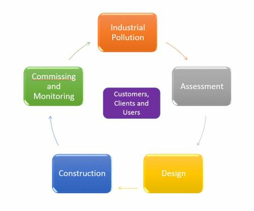
Environmental Impact Assessment (EIA survey or EIA study) is defined as to predict the environmental consequences i.e. positive and negative effects or in other words beneficial and detrimental effects / impacts of a planning activity for example designing and construction or widening of a highway / road project as in the present case.
An Environmental impact Assessment (EIA survey) is thus required to generate adequate baseline information, identify likely impacts on the environmental components, project these impacts into the future and finally provide decision makers with a document that suggests incorporation of environmental safeguards into the project planning and implementation.
This exercise has to be conducted in the planning stage itself to evaluate alternatives and to incorporate appropriate preventive / mitigative measures during the design stage at least costs.
Basic Approach and Scope of Work
The basic approach adopted for conducting the Environmental Impact Assessment (EIA survey) and EMP or EIA study for the project under consideration will closely follow the Terms of Reference (TOR) as prescribed by the World Bank and incorporated in the agreement.
The scope of work will cover the following stages :
- Preliminary Environmental Assessment / Screening
- Environmental Impact Assessment (EIA survey)
- Environmental Management plan
The Preliminary Environmental Assessment / Screening
This study will consist of a reconnaissance survey including field investigation, literature / field data collection, consultation with people and experts, and review and analysis of data. Relevant available documents will be collected and reviewed and officials of the concerned government departments, NGOs, local persons will be consulted.
- Inventory of sensitive locations issues within the corridor of influence
- Collection of database on relevant meteorological parameters, geological aspects, topography and natural drainage, soil characteristics, etc.
- Collection of air and water quality and noise level data from State and Central Pollution Control Board
- Data collected shall be reviewed for identification of the data gaps, which shall be subsequently filled up during the field study
- Field survey and related activities shall be undertaken for rapid estimation of trees and other environmental features within the Right-of- Way.
- Identification of locations for monitoring the air and water quality, noise level. and effluent within ROW in accordance with the State Pollution Control Board (SPCB), Central Pollution Control Board (CPCB), and MOEF guidelines and as required by the TOR.
- Public consultation to ascertain the perception of the project affected persons, stakeholders and NGOs regarding the environmental implications of the project.
Methodology or Environmental Impact Assessment Process
I) Collection and Review of Secondary Data :-
The data will be collected as per the standard formats devised for the purpose and the available secondary data shall be reviewed for characterization of baseline environmental set-up as follows:
- Meteorological Data (Rainfall, Seasons, Humidity, Temperature etc) Information on Geo-physical Aspects
- Relevant information on soil characteristics. topography and drainage and geology shall be gathered through review of District Gazetteers, Survey of India and
- District Geology maps etc. Soil characteristics will be studied in terms of its type, cohesion, and permeability. Topology and drainage study will focus on slope, terrain characteristics, and micro-drainage.
- Sensitive Location / Issues within Corridor of Influence:Forest Department Officials. NGOs and local people will be consulted for information on the sensitive locations such as National Parks, Reserved Forests, wild life sanctuary and issues like occurrence of rare / endangered flora and fauna, wildlife migration route, breeding ground of any endangered species etc.
- Air & Water Quality and Noise Level: The data available on air. water and noise quality will be collected from State / Central Pollution Control Boards
- Identification of Data Gaps :The data collected will be collcted and analyzed for identification of any gaps.
II) Collection of Field Data for EIA Study
- Inventory of Environmental features within ROW: Information on various environmental features such as ponds, soil type. water resources, wetlands, natural drainage channels, agricultural produces, plantations and species diversity, grass lands, natural vegetation and forest land within the proposed ROW will be recorded during field survey.
- Inventory of Public Facilities within proposed ROW: Public facilities such as hand pump, tube wells, sections of school buildings, hospitals and amusement parks will be recorded.
- Inventory of historical and religious structures: Archaeological monuments and structures of cultural and religious importance such as temples. mosques and graves will be recorded.
- Rapid Estimation of trees: Rapid tree inventory will be prepared as per standard format
- Selection of sites for Monitoring of Air & Water Quality and Noise level: Suitable locations will be identified for pre and post project monitoring of air and water quality and noise levels within the ROW and also to cover representative sensitive locations. Criteria for selection of Monitoring locations shall be based in accordance with the guidelines of Environment and Forest (MOEF):
- Samples of air will be collected and analyzed to monitor air quality nearby the residential. commercial, sensitive and industrial areas to establish the baseline status of the area for PM10, PM2.5, SO2, NOx, HC, CO, Pb, Ozone, Ammonia, Benzene, Benzo(a) Pyrene, Arsenic, Nickel.
- Water Quality: Water samples of ground water (dug well, hand pump and deep bore pumps) and surface water (rivers, lakes, streams etc.) of selected locations / sites will be collected and analyzed to monitor the pollution load caused due to road construction. The following parameters will be considered for the study: a) Physical Temperature, Odour and colour, Turbidity, Electrical conductivity (EC), pH, Suspended Solids (SS), Total Dissolved Solids (TDS). b) Chemical Dissolved Oxygen (DO). Biological Oxygen Demand(BOD), Chemical Oxygen Demand (COD), Alkalinity, Total Hardness (TH), Chlorides (Cl). Calcium (Ca), Magnesium (Mg), Sodium (Na), Potassium (K), Lead (Pb). Biological MPN total coliform (organism/100 ml), MPN faecal Coliform (organism/100 ml).
- Noise level: Background noise levels will be monitored both at day and night at different residential, industrial and sensitive areas. Sound / noise level values will be computed and compared with the standard permissible limits. More information on Noise Impact Assessment.
- Land Quality: Detailed land use pattern and soil fertility data will be obtained and if possible soil characteristics in terms of physical, chemical and biological parameters will be analyzed along the alignment of the road project for stretches of agricultural fields, dry lands, river banks etc.
- Other Environmental Attributes / Aesthetics: Environmental field survey will be conducted for studying the topographic character of the surrounding area to be removed or at locations of encroachments, Water bodies. Temples, Mosques, Graves, Green belt, etc.
- Public Consultation: Public consultation will be conducted using questionnaires to receive valued feedback from the project-affected persons. NGOs. local people and different stakeholders. Steps involved in public consultation process will include, (i) Appraising the respective persons about the project and also the anticipated environmental, socioeconomic and R & R implications of the proposed project, (ii) Recording their observation
Environmental Impact Assessment (EIA survey or EIA Study)
- The Environmental impact Assessment will be carried out in accordance with the prevailing institutional and legislative set-up of the Government of India and in conformity with the Environmental Impact Assessment Notification of the Ministry of Environment & Forest (MoEF), 1994 and Environmental Guidelines for Rail / Road / Highway Projects, MoEF, 1989.
- All requisite information will be collected and furnished to the concerned State and Central Government Authorities to obtain relevant environmental clearances at State & Central Govt, levels.
- The existing or baseline environmental conditions will be based on primary and secondary data collection as described under methodology. In addition a detailed strip map depicting prominent environmental features e.g. detailed inventory of all trees, encroachments, common property resources, public facilities (hospitals health clinics, educational institutions, religious structures. shrines, communication facilities etc.), agricultural activity, ponds etc. falling on both sides of the road and within the ROW will be prepared.
- Examination and Analysis of different alternatives is an essential part of the Environmental impact Assessment (EIA survey) process. To achieve this, following steps will be taken:
- a) The alternatives that were examined in the course of developing the proposed project will be described.
- b) Other alternatives, which would achieve the same objectives, will also be identified.
- c) Systematic comparison of the proposed investment design, site.technology, capital and recurrent costs: suitability under local conditions: institutional, training, and monitoring requirement. Noise Level monitoring and operational alternatives in terms of their potential environmental impacts (when describing the impacts, it will be indicated which are irreversible or unavoidable and which can be mitigated) will be carried out.
- d) For each of the alternatives, the environmental costs and benefits will be quantified to the extent possible. Other engineering alternatives that were examined and the basis for the selection of the alternative proposed for the project will be stated ‘With’ and 'Without' project scenario will be considered highlighting / justifying the all-round development of the economy and progress of the region concerned.
- Identification, assessment and distinction between positive and negative impacts, direct and indirect impacts, and immediate and long-term impacts likely to result from the proposed project will be done. The impacts, which are unavoidable or irreversible, shall be identified. Wherever, possible, the impacts will be described quantitatively, in terms of environmental costs and benefits. The extent and quality of available data will be characterized, explaining significant information deficiencies and any uncertainties associated with predictions of impacts will be identified and estimated. Mitigation measures and any residual negative impacts that cannot be mitigated, shall be identified. Opportunities for environmental enhancement will be explored. Topics that do not require further attention will be specified. Any studies needed to obtain the missing data shall be identified. The assessment of environmental impacts shall be explored on all the environmental components as listed under the baseline or existing environmental set-up.
- Feasible and cost effective mitigation measures to minimize negative impacts and enhance positive impacts by incorporating changes in the engineering design will be recommended at all stages of the project. The enhancement measures will include plantation of trees; beautification of ponds and other such features existing within the ROW. The norms followed by the World Bank would be integrated with those followed by the Government of India and would be implemented.
- An Environmental Management Action Plan will be formulated to identify the method of monitoring, implementation of mitigation measures and environment design as per the institutional framework.
- In order to successfully implement the environmental assessment recommendations, the needs for strengthening institutional arrangements will be identified. The authority and capability of insti tutions at local, provincial / regional, and national levels will be reviewed and steps to strengthen or expand them, so that the management and monitoring plans in the environmental assessment could be implemented. would be recommended. The recommendations may extend to new laws and regulations, new agencies or agency functions, intersectoral arrangements, management procedures and training, staffing, operation and maintenance training, budgeting, and financial support.
Environmental Management Plan
- a) The Environmental Management Plan will focus on mitigation measures, enhancement plans, institutional strengthening / training, monitoring.
- b) Mitigation I remedial measures for various adverse impacts will be described along with environmental design and cost estimates for each various environmental components.
- c) Similarly, environmental enhancement measures will also be defined along with environmental designs I drawings and estimated costs for each enhancement measures suggested.
- d) Institutional arrangements and reporting systems will be suggested to develop an implementation schedule and supervision programme for timely execution of environmental mitigation design works.
- e) An Environmental Monitoring Plan will be prepared for effective implementation of the Environmental Management Plan, The monitoring programme will be devised in such a way that it provides information to facilitate decision making during construction and operation phases. The monitoring plan will specify the environmental parameters to be monitored at specific locations and frequencies to achieve the level of environmental protection expected. The monitoring plan will also include detailed specifications with respect to methods, schedule etc. for evaluation of the effectiveness of the environmental management measures during operational stage of the project.